$12.95
$12.80
(SAVE Now!)
as of 12/22/2024 (Details)
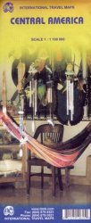
Double sided road and travel map covers the area from Belize and Guatemala to the border with Colombia at the scale of 1:1,100,000. It includes insets with Environs of San Jose (C.Rica), Panama Canal Area, Isla de Coco and Isla de San Andres. Distinguishes roads ranging from highways (paved/unpaved) to seasonal tracks. Legend includes swamps, glaciers, reefs, active volcanoes, railways, ferry routes, protected areas/national parks, international airports, domestic airports with scheduled services, landing grounds, points of interest, ruins, lighthouses, mines, beaches, gas stations, border crossing points. Extensive index, general information on the listed countries.
Technical Details
No features available.