$34.95
$27.11
(SAVE Now!)
as of 12/22/2024 (Details)
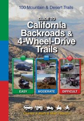
Full color throughout 100 Trails over 500 photos, 232 pages. This book replaces two previous black-and-white books that were written over a decade ago. In that time, some of the trails were closed. Of the ones still open, we whittled our list down to the best 100. We think these trails are, collectively, the best batch of California trails ever put together in one place. Whether you are a newcomer to 4-wheeling or an experienced veteran, we guarantee you'll have fun. This book features a new color format that is simpler and easier to use. Every detail about a trail appears on a handy two-page spread. Easy, moderate and difficult routes are color coded, while vehicle symbols quickly show kinds of vehicles allowed on each trail. This includes unlicensed UTVs, ATVs and dirt bikes. Reverse mileages are now included for all trails, and more historical highlights have been added. A separate mileage log has numbered locations that graphically jump off the page. Our new maps now include detailed relief backgrounds, referencing the numbered locations between the mileage log and map makes it easy to sense your location. In addition, exact GPS coordinates are provided for each numbered location.Every book includes concealed spiral binding that lays flat for easy use. Heavy-duty plastic laminate cover withstands rough use.Visit Funtreks website for GPS trails now available on SD cards for use in Garmin NUVI, Garmin Handheld devices, Iphone and Android devices.
Technical Details
No features available.