Rand McNally’s United States folded map features clear, easy-to-read cartography showing all Interstate and U.S. highways, along with clearly indicated cities, points of interest, airports, boundaries, and more. Rand McNally folded maps have been the trusted standard for years, offering unbeatable accuracy and reliability at a great price. Interstate and U.S. highways Indications of cities, points of interest, …
Rand McNally
Laminated and spiral bound Motor Carriers’ Road Atlas for heavy-duty users The #1 selling trucker’s road atlas in North America is as tough as the rig you’re driving. With its laminated pages and spiral binding, the Deluxe Motor Carriers’ Road Atlas can stand up to all of the wear-and-tear from the road. Save time and money with this …
The Rand McNally Road Atlas is the most trusted and best-selling atlas on the market. This updated 2020 edition contains maps of every U.S. state and Canadian province, an overview map of Mexico, and detailed inset maps of over 350 cities and 25 national parks. Road construction and conditions contact information for every state conveniently located above the …
Pinpoint the best in the best: America’s 60 national parks. With essential information and tips, hundreds of photos and maps, and a complete road atlas, this guide is all you need to have extraordinary park experiences. A four-color, 132-page National Park Guide details the best of the best in each park—from trails, drives, and natural wonders to programs, …
A durable see-through cover enhances the classic Rand McNally Road Atlas, making it travel-ready with added protection against constant use, spills and exposure to the elements. The most trusted and best-selling road atlas on the market, this updated 2020 edition contains maps of every U.S. state and Canadian province, an overview map of Mexico, and detailed inset maps …
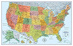
Updated and redesigned, Rand McNally’s Signature United State wall map features eye-catching bold and vivid colors that make this the perfect reference piece sure to stand out in any home, classroom or office. The precise detail and digital accuracy shows color-matching relief and other physical features without sacrificing the maps readability. Printed on high quality paper. U.S. FeaturesState …
Rand McNally 2017 Road Atlas (Rand Mcnally Road Atlas: United States, Canada, Mexico)
2017 Road AtlasOverviewThe Rand McNally Road Atlas is the most trusted and best-selling US atlas on the market. This updated North American atlas contains maps of every U.S. state and Canadian province, an overview map of Mexico, and detailed inset maps of over 350 cities and 20 U.S. national parks. Road construction and conditions contact information for every …
Rand McNally 2017 Large Scale Road Atlas (Rand Mcnally Large Scale Road Atlas USA)
2017 Large Scale Road AtlasOverviewGive road-weary eyes a break with this spiral-bound Large Scale edition featuring all the accuracy you’ve come to expect from Rand McNally, only bigger. Updated atlas contains maps of every U.S. state that are 35% larger than the standard atlas version plus over 350 detailed city inset and national park maps and a comprehensive, …
Capture the heart and spirit of the United States on your coffee table with Rand McNally’s beautiful hardcover America book. America explores the ways in which history, land, people, and culture give each region of our country its unique character. Features include: More than 300 breath-taking photos, including full spread images to lead off each regional section Essays, …
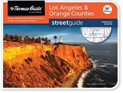
Thomas Guide: Los Angeles & Orange Counties (Thomas Guide Streetguide Los Angeles and Orange County)
FEATURES 2015 copyright Landscape layout with lay-flat spiral binding Maps, points of interest, and their indexes are completely revised Includes transit information, airports, schools, shopping centers, parks and recreation areas Administrative and zip code boundaries included Block numbers on maps and in index Township tier, range and section numbers Full coverage of over 400 cities and communities …
